Subsurface Utility Mapping
Subsurface Utility Mapping (SUM), combined with our surveying and engineering team solutions, helps to manage the risks associated with underground utility mapping saving time and money for your project. According to a Purdue University Study*, for every $1.00 spent on SUE stakeholders realize a related $4.62 minimum estimated savings on project costs. Based upon this, a recent 25 acre site had a projected claims avoidance estimate of $22,000 overall on their project! This in itself reduces the need for redesigns and change orders during the construction phases of projects, and also decreases “risk factors” applied to contractor bids saving an estimated 14% on projects.
TeaCo Geophysical takes an integrated geophysical approach in commercial and residential subsurface utility mapping as we've implemented multiple complimentary geophysical platforms to conduct our high level SUM projects. TeaCo believes that by having all of the required licensed professionals onsite simultaneously significantly reduces project costs and delays from unknown subsurface discoveries as potential errors can be identified and corrected while our team is onsite. Resulting in the reduction in or elimination of delays and increased costs as it relates to mobilization which in turn increases overall project efficiency.
Specifically as related to American Society of Civil Engineers (ASCE 38-02) standard TeaCo can perform the entire range of requested field services up Level A where actual vacuum excavating potholing is mandated to physically verify spatial and vertical positions of utilities, but also type of material and depths to tops can also be derived. Implementation of this integrated project management process affords TeaCo to accurately record, interpret, and manage data derived from SUM in accordance with ASCE 38-02 standards.
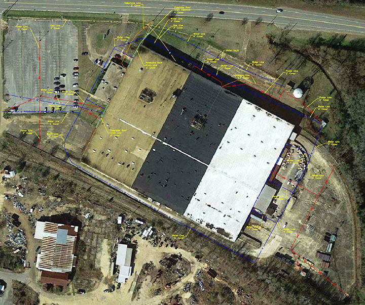
Commercial Applications
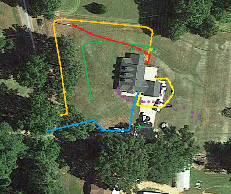
Residential Applications